
Summary
Keywords
Full Transcript
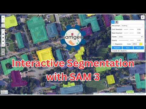
🚀 Interactive Segmentation of Remote Sensing Imagery with SAM 3 This video tutorial demonstrate a new capability in the SamGeo Python package: fully interactive image segmentation powered by Meta’s SAM 3! With just a simple prompt, you can now extract objects from satellite or aerial imagery, no training, no manual labeling, no complex setup. 🟦 Draw a bounding box to automatically detect all similar objects across the scene. 📝 Type a text prompt to instantly segment objects of interest. This makes geospatial analysis faster, more intuitive, and more accessible, whether you're mapping buildings, water bodies, vegetation, or any objects in large imagery. 🔗 GitHub Repository (SamGeo): https://github.com/opengeos/segment-geospatial 🔗 Notebook Example: https://samgeo.gishub.org/examples/sam3_interactive/ 📺 Check out the full video tutorial at https://youtube.com/@giswqs/videos #SAM3 #GeoAI #Geospatial #OpenSource #Python #datascience --------------------------------------------------------- 📌 More Resources: 📺 GeoAI Playlist: https://www.youtube.com/playlist?list=PLAxJ4-o7ZoPcvENqwaPa_QwbbkZ5sctZE 📚 Get my new Books: 📘 Introduction to GIS Programming: A Practical Python Guide to Open Source Geospatial Tools 👉 Amazon: https://amazon.com/dp/B0FFW34LL3 👉 Leanpub: https://leanpub.com/gispro 📘 Spatial Data Management with DuckDB: From SQL Basics to Advanced Geospatial Analytics 👉 Amazon: https://amazon.com/dp/B0G2JFMFFC 👉 Leanpub: https://leanpub.com/duckdb 👋 Let’s Connect: YouTube: https://youtube.com/@giswqs LinkedIn: https://www.linkedin.com/in/giswqs Twitter: https://twitter.com/giswqs Facebook: https://www.facebook.com/groups/opengeos

Continue this lesson in the app
Install CourseHive on Android or iOS to keep learning while you move.



