
Summary
Keywords
Full Transcript
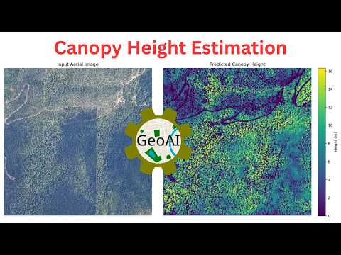
Learn how to estimate canopy height from aerial and satellite imagery using pretrained deep learning models with the GeoAI Python package. This step-by-step tutorial shows you how to use Meta's High-Resolution Canopy Height Model with minimal code! Video Tutorial: https://youtu.be/vsIRTM98qaU Notebook Example: https://opengeoai.org/examples/canopy_height Meta's Canopy Height Model: https://github.com/facebookresearch/HighResCanopyHeight #GeoAI #RemoteSensing #CanopyHeight #DeepLearning #Python #OpenSource --------------------------------------------------------- 📌 More Resources: 📺 GeoAI Playlist: https://www.youtube.com/playlist?list=PLAxJ4-o7ZoPcvENqwaPa_QwbbkZ5sctZE 📚 Get My Books: 📘 Introduction to GIS Programming: A Practical Python Guide to Open Source Geospatial Tools 👉 Amazon: https://amazon.com/dp/B0FFW34LL3 👉 Leanpub: https://leanpub.com/gispro 📘 Spatial Data Management with DuckDB: From SQL Basics to Advanced Geospatial Analytics 👉 Amazon: https://amazon.com/dp/B0G2JFMFFC 👉 Leanpub: https://leanpub.com/duckdb 👋 Let’s Connect: YouTube: https://youtube.com/@giswqs LinkedIn: https://www.linkedin.com/in/giswqs Twitter: https://twitter.com/giswqs Facebook: https://www.facebook.com/groups/opengeos

Continue this lesson in the app
Install CourseHive on Android or iOS to keep learning while you move.



